Revúca District (Okres Revúca)
Revúca District (okres Revúca) is a district in the Banská Bystrica Region of central Slovakia. District had been established in 1996. Forests make 60% of the district area. Revúca District consist of 42 municipalities, from which three have a town status. In the district is 1 national park Muránska planina. The highest concentration of industry is in the zone Revúca-Lubeník-Jelšava, otherwise trade and agriculture dominates the district economy. Seat of the district is town Revúca. Overall, economy development of the district is under Slovakia's average.
* Držkovce
* Gemer
* Gemerská Ves
* Gemerské Teplice
* Gemerský Sad
* Hrlica
* Hucín
* Chvalová
* Chyžné
* Držkovce
* Gemer
* Gemerská Ves
* Gemerské Teplice
* Gemerský Sad
* Hrlica
* Hucín
* Chvalová
* Chyžné
Map - Revúca District (Okres Revúca)
Map


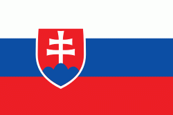
Country - Slovakia
 |
 |
| Flag of Slovakia | |
The Slavs arrived in the territory of present-day Slovakia in the fifth and sixth centuries. In the seventh century, they played a significant role in the creation of Samo's Empire. In the ninth century, they established the Principality of Nitra, which was later conquered by the Principality of Moravia to establish Great Moravia. In the 10th century, after the dissolution of Great Moravia, the territory was integrated into the Principality of Hungary, which then became the Kingdom of Hungary in 1000. In 1241 and 1242, after the Mongol invasion of Europe, much of the territory was destroyed. The area was recovered largely thanks to Béla IV of Hungary, who also settled Germans, leading them to become an important ethnic group in the area, especially in what are today parts of central and eastern Slovakia.
Currency / Language
| ISO | Currency | Symbol | Significant figures |
|---|---|---|---|
| EUR | Euro | € | 2 |
| ISO | Language |
|---|---|
| HU | Hungarian language |
| SK | Slovak language |